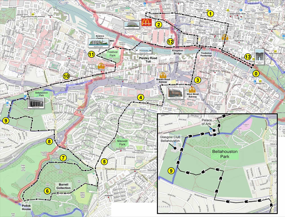
First 5 miles
Left on to CLYDE STREET. Right at DIXON STREET and continue through ST ENOCH'S SQUARE to BUCHANAN STREET. Left at ST VINCENT STREET. Left at police station on FINNIESTON STREET. Left at McDonald's on HOULDSWORTH STREET past the Paras After the Salvation Army and Anderston Kelvingrove Church, this becomes ARGYLE STREET. Continue past Sanctuary Scotland down to the pedestrian crossing under the Kingston Bridge approaches at Anderston Rail Station on Argyle Street. Right at JAMES WATT STREET and cross over the TRADESTON FOOTBRIDGE. Right at CLYDE PLACE then left at WEST STREET. At the end of West Street, right on SCOTLAND STREET. Left at SHIELDS ROAD SUBWAY on SHIELDS ROAD.
5 miles to 10 miles
At traffic lights, right on ST ANDREW'S DRIVE across from the entrance to Pollok Park (this is were we will be coming out.Take the second road on the left, HAGGS ROAD all the way to the Haggs Road entrance to POLLOCK PARK (at the traffic lights at Shawmoss Road).
Right into the park and follow the road past the Burrell car park then left and right on the path that leads to Pollok House. Just before Pollok House, go right and follow the road all the way to the exit oppoiste St Andrew's Drive and go left on DUMBRECK ROAD. Left at MOSSPARK BOULEVARD and take the route through BELLAHOUSTON PARK shown below leaving the park behind the Palace of Arts.
Last 3 miles
In leaving Bellahouston Park, right at PAISLEY ROAD WEST. Left at HARVIE STREET (at the District Bar) and past the Louden Tavern to Govan Road. Left at GOVAN ROAD then right on PACIFIC DRIVE to the SQUINTY BRIDGE. Cross the bridge then go right on BROOMIELAW and CLYDE STREET back to the start.